

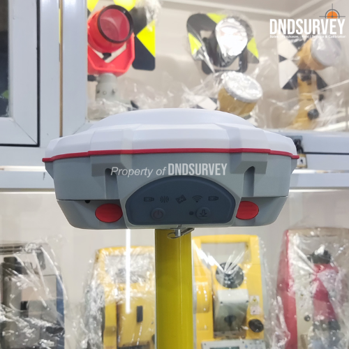
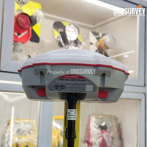


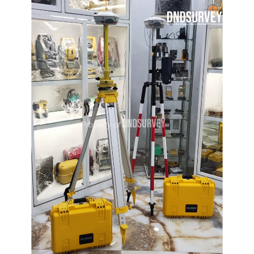
GPS RTK SinoGNSS T300 Plus dilengkapi 965 channel full constellation, IMU tilt hingga 60°, UHF internal Tx/Rx, serta 4G & WiFi bawaan untuk koneksi CORS. Memiliki akurasi RTK tinggi, IP68 tahan air & debu, baterai hot swap, dan software Survey Master Android untuk pekerjaan survey yang cepat, stabil, dan presisi.
Gps Rtk SinoGnss T300 Plus
Rp110,000,000
Description
Gps Rtk SinoGnss T300 Plus

SinoGNSS T300 Plus adalah GPS RTK geodetik profesional yang dirancang untuk kebutuhan survey presisi tinggi seperti pemetaan topografi, pengukuran lahan, konstruksi, pertambangan, dan proyek infrastruktur. Dilengkapi 965 channel full constellation GNSS, teknologi IMU tilt hingga 60°, serta konektivitas 4G, WiFi, Bluetooth, dan UHF internal, T300 Plus mampu memberikan hasil pengukuran yang cepat, stabil, dan sangat akurat di berbagai kondisi lapangan.
Receiver ini mendukung metode RTK, Static, PPK, dan Network RTK (CORS) sehingga fleksibel digunakan oleh surveyor pemula maupun profesional. Dengan desain tangguh IP68, baterai hot swap, dan software Survey Master berbasis Android, SinoGNSS T300 Plus menjadi solusi ideal untuk meningkatkan produktivitas pekerjaan survey.
Fitur Unggulan SinoGNSS T300 Plus
- 965 Channel Full Constellation GNSS Mendukung GPS, GLONASS, BeiDou, Galileo, QZSS, NavIC, dan SBAS untuk akurasi maksimal.
- IMU Tilt Survey hingga 60° Pengukuran tanpa rambu tegak dengan akurasi hingga 2.5 cm, meningkatkan kecepatan kerja.
- RTK Presisi Tinggi Akurasi RTK:
- Horizontal: 8 mm + 1 ppm
- Vertikal: 15 mm + 1 ppm
- UHF Internal Tx & Rx (410–470 MHz) Jangkauan hingga 5 km (kondisi ideal), daya pancar dapat disesuaikan.
- Modem 4G & WiFi Terintegrasi Siap digunakan dengan CORS / Network RTK di seluruh Indonesia.
- Hot Swap Dual Battery Menggunakan baterai kompatibel Canon LP‑E6, mudah dicari dan dapat diganti tanpa mematikan alat.
- IP68 Waterproof & Dustproof Tahan cuaca ekstrem, benturan, dan lingkungan kerja berat.
- Bluetooth & USB Mode Mudah terhubung ke data collector Android / Windows.
- Memori Internal 8 GB Penyimpanan data survey lebih aman dan praktis.
- Survey Master Android Software Antarmuka sederhana, mendukung RTK, Static, PPK, Stake Out, Mapping, dan CAD Import.
Spesifikasi Produk :
| Model | T300 Plus |
|---|---|
| Signal Tracking | |
| 965 channels for simultaneously tracking satellite signals | - GPS: L1C/A, L2C, L2P, L5 |
| - BeiDou: B1I, B2I, B3I, B1C, B2a, B2b | |
| - GLONASS: L1, L2, L3 | |
| - Galileo: E1, E5a, E5b, E6, AltBOC | |
| - QZSS: L1C/A, L1C, L2C, L5 | |
| - Navic: L5 | |
| - SBAS: WAAS, EGNOS, MSAS, GAGAN, SDCM, BDSBAS | |
| Performance Specifications | • Cold start: <50 s |
| • Warm start: <30 s | |
| • Hot start: <15 s | |
| • Initialization time: <10 s | |
| • Signal re-acquisition: <1.5 s | |
| • Initialization reliability: >99.9% | |
| Positioning Specifications | |
| Post Processing (static and fast static) | - Horizontal: 2.5 mm + 0.5 ppm |
| - Vertical: 5 mm + 0.5 ppm | |
| Long Observations Static | - Horizontal: 3 mm + 0.1 ppm |
| - Vertical: 3.5 mm + 0.4 ppm | |
| Real Time Kinematic | - Horizontal: 8 mm + 1 ppm |
| - Vertical: 15 mm + 1 ppm | |
| DGPS:<0.4m RMS | |
| • SBAS: 1 m 3D RMS | |
| • Standalone: 1.5 m 3D RMS | |
| Communications | 1 x 7 pin lemo port (Combined Serial and USB function) Baud rates up to 921600bps for serial |
| UHF modem1: Tx/Rx with full frequency range from 410-470 MHz2 - Transmit power: 0.5-2 W adjustable - Range: 1-5 km3 |
|
| WIFI/4G modem1 - LTE-FDD:B1/B2/B3/B4/B5/B7/B8/B12/B13/B18/B19/B20/B25/B26/B28 - LTE-TDD: B38/B39/B40/B41 - WCDMA: B1/B2/B4/B5/B6/B8/B19 - GSM: B2/B3/B5/B8 |
|
| Position data output rates: 1 Hz, 2 Hz, 5 Hz, 10 Hz, 20 Hz | |
| 5 LEDs (indicating Power, Satellite Tracking, GPRS Status and Differential Data) |
|
| Bluetooth® : V 4.0 protocol, compatible with Windows OS and Android OS | |
| Calibration-free IMU integrated for Tilt Survey, up to 60° tilt with 2.5 cm accuracy |
|
| Data Format | |
| Correction data I/O: | - RTCM SC104 Version 2.x, 3.x formats,CMR(GPS only),CMR+(GPS only) |
| Position data output: | - ASCII: NMEA-0183 GSV, RMC, HDT, VHD, GGA, GSA,ZDA, VTG, GST; PTNL, PJK; PTNL, AVR; PTNL, GGK |
| - ComNav Binary update to 20 Hz | |
| Physical | • Size(W × H): Φ 15.8 cm × 7.5 cm |
| • Weight: 0.95 kg with two batteries | |
| Environmental | • Operating temperature: --40 °C to + 65 °C (--40 °F to 149 °F) |
| • Storage temperature: --40 °C to + 85 °C (--40 °F to 185 °F) | |
| • Humidity: 100% non-condensing | |
| • Waterproof and dustproof: IP68 | |
| • Shock: Designed to survive a 2 m drop onto concrete | |
| Electrical and Memory | • Input voltage: 7-28 VDC |
| • Power consumption: 1.92 W4 | |
| • Li-ion battery capacity: 2 × 2000 mAh, up to 10 hours typically | |
| • Memory: 8 GB5 | |
| Software | Software |
| • Survey Master Android-based data collection software | |
| • Carlson SurvCE field data collection software (optional) | |
| • MicroSurvey FieldGenius field data collection software (optional |
Sudah Termasuk dengan :
- Base & Rover
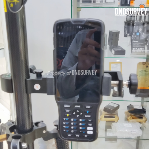
- Controller
- Tripod
- Stik Pole Survey
- dan pelengkap lainnya
Garansi 1 Tahun
Dapatkan sekarang juga hanya di DND Survey
Harap tanya ketersediaan stok terlebih dulu ya sebelum order:)
Note:
*Membeli = Setuju
*sertakan video unboxing untuk klaim garansi.
*apabila tidak terdapat video unboxing maka klaim garansi tidak berlaku.
*Harga Dapat Berubah Sewaktu-waktu tanpa pemberitahuan terlebih dahulu.
*Mohon tanya ketersediaan barang terlebih dahulu.
*Barang selalu kami cek terlebih dahulu sebelum di kirim.
*Barang di toko kami di jamin original dan baru.
Waktu Pengiriman :
*Senin dan Jumat pukul 11.00 – 15.30 barang langsung dikirim.
*Sabtu pukul 11.00 barang langsung dikirm.
*hari minggu dan libur nasional, dikirim hari berikutnya.
Atau Kunjungi Langsung Office Store Kami :
Alamat : Komplek Sukamenak Indah Block R No.11 Kopo Sayati,Kab Bandung, Jawa Barat 40227.