| GNSS CHARACTERISTICS | |
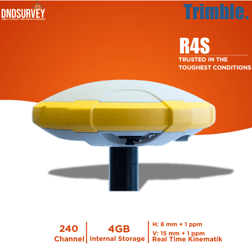
| 240 GNSS channels | - GPS LIC/A, LIP(Y), L2P(Y), L2C |
| - GLONASS LIC/A, L2C/A, L3 |
| -BeiDou Bl (phase 2), B2 |
| -Galileo El, E5b |
| -Qzss LIC/A, L2C, Ll SAIF - SBAS LIC/A |
| -L-band |
| -Supports Trimble RTX real-time correction services | |
| -Patented Z-Blade technology for optimal GNSS performance | |
| -Full utilization of signals from all 6 GNSS systems | |
| (GPS, GLONASS, BeiDou, Galileo, Qzss and SBAS) | |
| -Enhanced GNSS-centric algorithm for fully independent GNSS tracking and optimal data processing (Incl. GPS-only and GLONASS-only) | |
| -Fast search engine for quick acquisition and reacquisition of GNSS signals | |
| -Patented SBAS ranging (code & carrier observations) | |
| -Patented Strobe Correlator for reduced GNSS multi-path | |
| -Up to 10 Hz real-time raw data output | |
| -Supported data formats: ATOM, CMR, CMR+, RTCM 2.1, 3.0, 3.1 and 3.2(lncl. MSM), CMRx and sCMRx | |
| -NMEA 0183 message output | |
| * REAL-TIME ACCURACY (RMS) | |
| SBAS (WAAS/EGNOS/MSAS/GAGAN) | |
| - Horizontal: | < 50 cm |
| - Vertical: | < 85 cm |
| * Real-time DGPS position | |
| - Horizontal: | 25 cm + 1 ppm |
| - Vertical: | 50 cm + 1 ppm |
| * Real-time Kinematic position (RTK) | |
| - Horizontal: | 8 mm + 1 ppm |
| - Vertical: | 15 mm + 1 ppm |
| Real-time performance | |
| Instant-RTK initialization | |
| Typically 2 sec for baselines < 20 km | |
| Up to 99,9% reliability | |
| RTK initialization range: over 40 km | |
| * POST-PROCESSING ACCURACY (RMS) | |
| Static & Fast static | |
| - Horizontal: | 3 mm + ppm |
| - Vertical: | 5 mm + ppm |
| High-precision Static 3 | |
| - Horizontal: | 3 mm + ppm |
| - Vertical: | 3,5 mm + ppm |
| Post-processed Kinematic (PPK) | |
| - Horizontal: | 8 mm + 1 ppm |
| - Vertical: | 15 mm + 1 ppm |
| DATA LOGGING CHARACTERISTICS | |
| Recording interval O, 1 - 999 seconds | |
| PHYSICAL CHARACTERISTICS | |
| Size | 21 x 21 x 7 cm |
| Weight | 930 g |
| User Interface | |
| Five LED's - Power, Tracking, BlueTooth, Recording and Radio operation | |
| I/O Interface | |
| RS-232 serial link | |
| USB 2.0/UART and USB OTG | |
| Bluetooth 2.1 + EDR / Long range: Class 1 (19dbm) | |
| * Memory | |
| - 256 Mb internal memory NAND Flash | |
| - 30+ Days of 15 sec raw GNSS Data (14 Satellites) | |
| * Operation | |
| - RTK base & rover | |
| - RTK VRS network rover | |
| - NTRIP, Direct IP | |
| - Post-processing | |
| - Trimble RTX (satellite and cellular / IP) | |
| Environmental characteristics | |
| - Operating temperature: | -40°C to +65°c ⁴ |
| - Storage temperature: | -40°C to +85°c⁵ |
| - Humidity: | 100% condensing |
| - IP67 waterproof (sealed against sand & dust) | |
| - Drop: | 2m Pole-drop on concrete |
| - Shock: | MIL STD 810 (fig. 516.5-10) (01/2000) |
| Vibration: | MIL STD 810 (fig. 516.5-10) (01/2000) |
| Power characteristics | |
| - Li-on battery, 7,4V / 2600 mAh | |
| - Battery life: 1 | 0 hrs (GNSS On ; UHF Rx Off) 8 hrs (GNss On ; UHF Rx on) |
| External DC power: | 9 - 28V |
| - Standard system components | |
| - Trimble R4s GNSS receiver | |
| - Li-on battery | |
| - Dual battery charger, power supply & cord kit | |
| - Tape measure (3,6m) | |
| - 7cm Pole extension | |
| - USB to mini-USB comm cable | |
| - R4s internal UHF Kit (410-470 MHz, 2W, TRx) | |
| - 2 Year receiver warranty | |
| - Trimble TSC3 Data collector | |
| - Trimble ACCESS field software | |
| Optional system components | |
| - R4s Field power kit | |
| - R4s Office power kit | |


Reviews
There are no reviews yet.